Category: 2016/17
Weather Info
back track to root websites for info other than Cumberland area
windfinder- pretty decent forecast
http://www.windfinder.com/forecast/st_marys_river
knots to mph conversion
http://www.disastercenter.com/convert.htm
iwindsurf: click features on the map for good easy-reading colorful info charts
http://wx.iwindsurf.com/map#30.88,-80.97,9,1,!1883,2
fishweather. scroll down past the graphs to the text descriptions of conditions, further for the wind archives and monthly windy days stats
http://www.fishweather.com/spot/71197
in-depth tide forcast
http://www.tide-forecast.com/locations/Amelia-City-Florida/tides/latest
Cumberland Paddling Reports
solid information. for instance “The outgoing tidal currents in the Cumberland Sound will be pushing you toward Amelia Island and the Atlantic Ocean, so you’ll want to monitor your ferry angle as you cross the Sound.”
Ga Coastal Resources Division
Cumberland Island Trip Map
Dawson Forest
Etowah River
from: River Park on Ga Hwy 9 near Dawsonville
to: Kelly Bridge Rd. near Dawsonville
length: 9 mi
Kayak Rental/ Shuttle:
http://www.canoegeorgia.com/canoe.php4#Dawson
Jay:
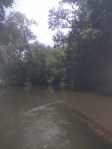
Did solo trip on July 9. Spotted bass, Redeye, and sunfish were plentiful. Some photos: