
Caper’s island is 3 miles long and half mile wide (not counting the marsh) with and area of 1.6 sq miles. Marsh side landing opportunities will be limited to a dock on Schooner Creek, about halfway up the island. Beachside landings seem like the way to go here.
Here’s an overview of the paddle I have in mind. Definitely tide dependent.
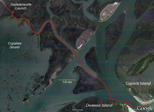
For fishing, in addition to the marsh creeks there is Copahee Sound nearby. Check out this video if you’re curious as to what is out there. There is occasionally some discussion on the Charlestonfishing.com forums about this place.
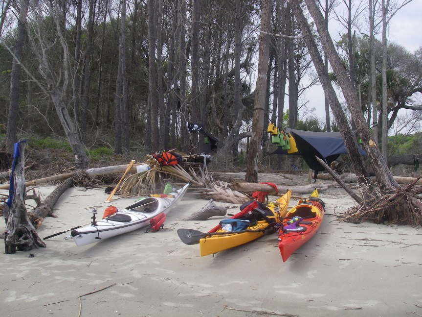
Looks like hanging spots won’t be too hard to find. Take a look at the picture below, also check it out on Google maps. If that isn’t hammock hangs for days then I don’t know what is.
It doesn’t look like there is any fresh water there, so we’ll need to bring plenty. The impoundment at the south end of the island has a tide gate, so I imagine it’s at least somewhat salty. No facilities, the island is almost entirely undeveloped. Also the description from sctrails.com mentioned that while there are about 5 miles of trails on the island they may be overgrown, especially with poision ivy and poison oak. Also, much like Cumberland Island, bring PLENTY of insect repellent.
